LiDAR Import for PGA 2000 (and probably TW)
Posted: November 19th, 2022, 10:57 am
I finally had time to develop my process for importing LiDAR into the PGA 2000 architect. I had known how I was going to do it for a couple months now but I didn't have time to develop it until a couple weeks ago. This will basically give you all of the elevations of the course including fine details like green contours, small fairway contours, and tees, as opposed to just the general slopes of the plot like we were getting with the old system using Terrain Assist.
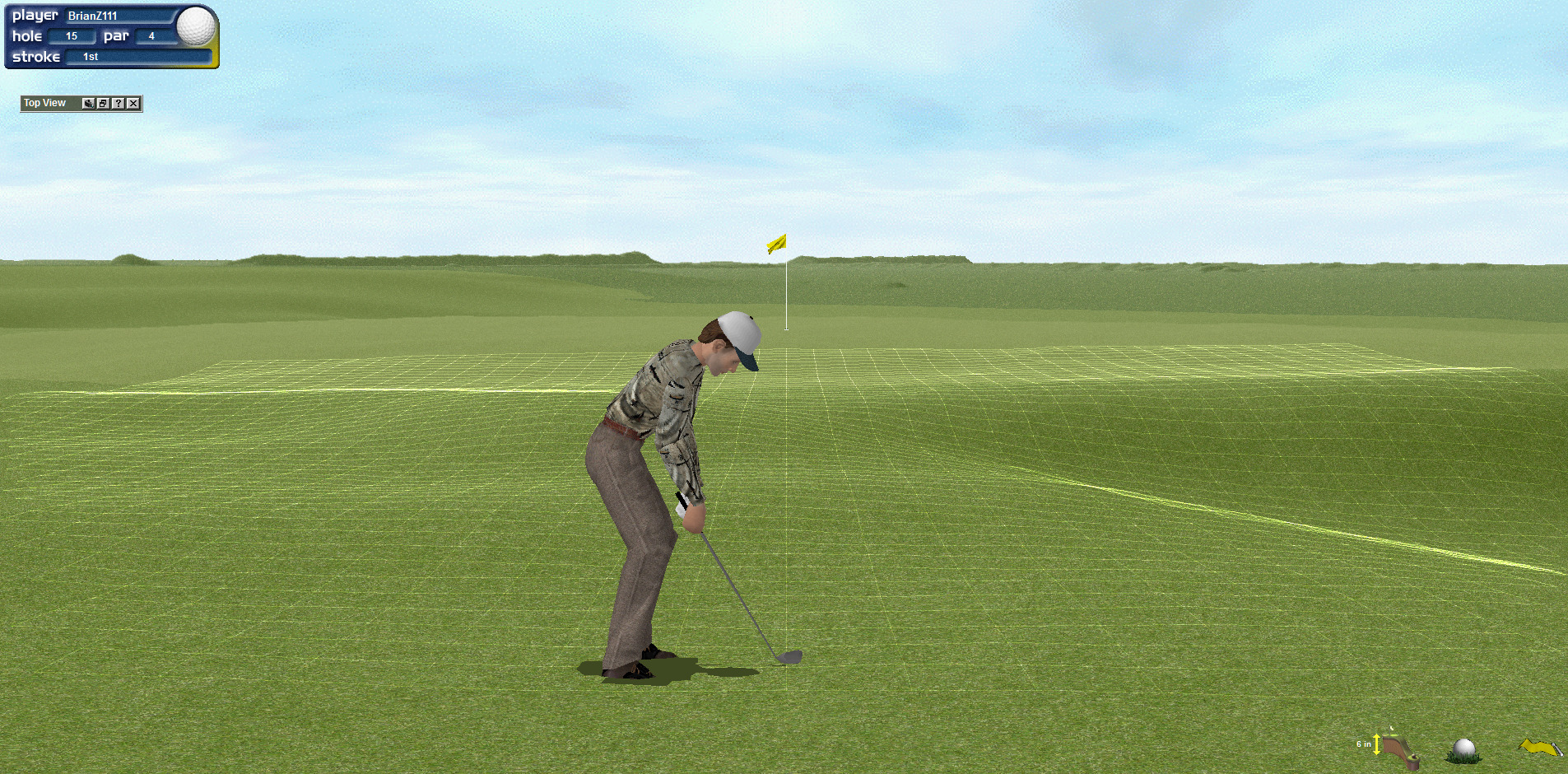
Here's a screenshot just off the front left side of the 18th at North Berwick, which will give you a good idea of the contour retained in the fairway and green. (the hills on the horizon are not from North Berwick, these images have imports from multiple sources on the same plot)

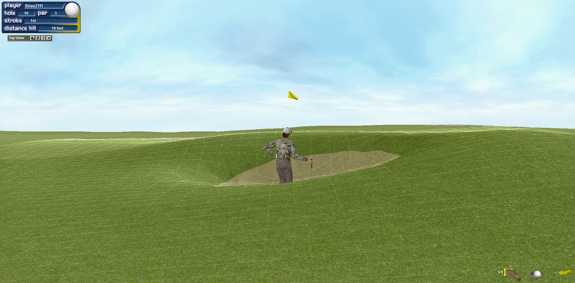
The main thing you won't get is bunker edges. Here, the 11th at St. Andrews gives you and idea of how much work you'd have to do to fix a revetted bunker, which is the most extreme case. The depth is there but the sidewalls need to be fixed. Most common bunkers will just need a bit of definition added around the edges.

Depending on the quality of the data, there may be some other things. The places where slope changes quickly from gentle to steep are the places to look for areas in need of fixing. On older or poor quality data, raised greens could see some rounding off effect around the edges of the green that needs to be fixed but I don't expect it to be a common problem.
This should work in the TW08 and older series when Headgate was the developer as well since they didn't ever change the architect much, but I haven't actually tried it in those games yet.
I will eventually write a tutorial but right now I am relying on Global Mapper for part of the process so that probably eliminates most people from doing it. There is probably a cheap or free replacement but I'd have to research it and that wouldn't come until after I write the tutorial using Global Mapper which is also a ways off.
However, I'm happy to help anyone who wants to do a LiDAR based design by creating a plot for you with the caveat that work is extremely busy for me right now so I probably won't get it to you very fast after request. For example there's no way I'd have any time in the next week but maybe in a two week lead time I could find a spot to fit it in. I'm also only going to fill another request form the same person after a previous request has been released as a finished course. I'm sharing my methods and work because I'm trying to encourage more courses to be released for this game again.
Here's a screenshot just off the front left side of the 18th at North Berwick, which will give you a good idea of the contour retained in the fairway and green. (the hills on the horizon are not from North Berwick, these images have imports from multiple sources on the same plot)
The main thing you won't get is bunker edges. Here, the 11th at St. Andrews gives you and idea of how much work you'd have to do to fix a revetted bunker, which is the most extreme case. The depth is there but the sidewalls need to be fixed. Most common bunkers will just need a bit of definition added around the edges.
Depending on the quality of the data, there may be some other things. The places where slope changes quickly from gentle to steep are the places to look for areas in need of fixing. On older or poor quality data, raised greens could see some rounding off effect around the edges of the green that needs to be fixed but I don't expect it to be a common problem.
This should work in the TW08 and older series when Headgate was the developer as well since they didn't ever change the architect much, but I haven't actually tried it in those games yet.
I will eventually write a tutorial but right now I am relying on Global Mapper for part of the process so that probably eliminates most people from doing it. There is probably a cheap or free replacement but I'd have to research it and that wouldn't come until after I write the tutorial using Global Mapper which is also a ways off.
However, I'm happy to help anyone who wants to do a LiDAR based design by creating a plot for you with the caveat that work is extremely busy for me right now so I probably won't get it to you very fast after request. For example there's no way I'd have any time in the next week but maybe in a two week lead time I could find a spot to fit it in. I'm also only going to fill another request form the same person after a previous request has been released as a finished course. I'm sharing my methods and work because I'm trying to encourage more courses to be released for this game again.